

What is the role of remote sensing in fire management?
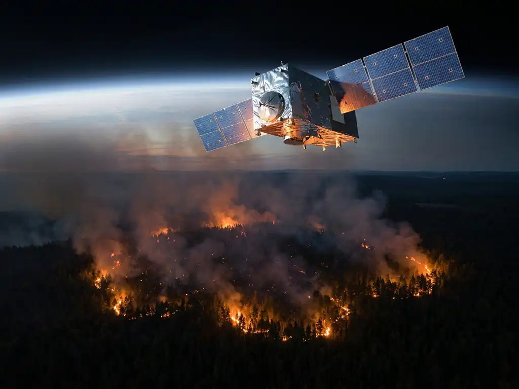
Remote sensing plays a central role in fire management by enabling the detection, monitoring, and assessment of fires across vast landscapes without requiring a physical presence on the ground. Satellite imagery, aerial sensors, and ground-based optical systems allow fire managers to identify ignition points early, track fire spread in near real time, and evaluate damage after a fire has been contained. The sections below unpack each of these capabilities in detail, from detection methods to post-fire recovery support.
How does remote sensing detect fires before they spread?
Remote sensing detects fires before they spread by identifying heat signatures, smoke plumes, and changes in vegetation that indicate early ignition or high fire risk. Thermal infrared sensors aboard satellites and aircraft can register temperature anomalies well before a fire becomes visible to the naked eye, giving fire managers a critical window to respond.
The detection process typically works in two layers. The first is passive thermal monitoring, where sensors measure the natural heat emitted by the Earth’s surface and flag areas where temperatures exceed normal thresholds. The second layer involves spectral analysis, which tracks changes in vegetation moisture and density. Dry, stressed vegetation reflects light differently than healthy plant matter, and these spectral signatures can signal elevated fire risk days or weeks before an ignition event.
When combined with weather data such as wind speed, humidity, and temperature forecasts, remote sensing outputs feed into fire danger rating systems that help authorities prioritize surveillance and pre-position firefighting resources. This predictive capacity is what makes remote sensing in fire management so valuable compared to reactive ground-based detection alone.
What types of remote sensing are used in fire management?
Fire management relies on several distinct types of remote sensing, each suited to a different scale, speed, or purpose. The main categories are satellite-based sensors, airborne platforms, and ground-level optical systems, and they are often used in combination to build a complete picture of fire behavior and risk.
Satellite-based remote sensing
Satellites are the backbone of large-scale wildfire detection and monitoring. Systems such as NASA’s MODIS and VIIRS instruments provide daily global coverage, detecting active fire locations and estimating burned area. Higher-resolution commercial satellites can revisit specific sites multiple times per day, which is essential for tracking fast-moving wildfires. The European Copernicus program, through its Sentinel satellites, also provides freely accessible data used widely in remote sensing forest fire applications.
Airborne and drone-based sensing
Manned aircraft and unmanned aerial vehicles (UAVs) offer a level of spatial detail that satellites cannot always match. Equipped with thermal cameras, LiDAR, or multispectral sensors, these platforms can fly at low altitude over active fire zones, providing high-resolution mapping of fire perimeters and hotspots. Drones in particular have become increasingly practical for deploying fire detection technology in remote or rugged terrain where satellite revisit times are too infrequent for operational decisions.
How is remote sensing used to map and monitor active wildfires?
Remote sensing is used to map and monitor active wildfires by continuously tracking fire perimeters, hotspot locations, smoke dispersion, and rate of spread. This real-time intelligence allows incident commanders to allocate firefighting resources more effectively and issue timely evacuation warnings to communities in the fire’s path.
Satellite fire monitoring platforms process thermal data to produce fire radiative power measurements, which estimate the intensity of combustion at any given location. These outputs are updated as frequently as every few minutes with geostationary satellites, giving fire managers a near-continuous view of how a wildfire is evolving. Fire behavior models then ingest this data alongside topography and fuel maps to project where the fire is likely to move next.
Smoke plume tracking is another critical monitoring function. By analyzing aerosol optical depth and wind patterns, remote sensing systems can predict where smoke will travel, informing air quality advisories and public health decisions far downwind of the active fire. This broader situational awareness is one of the most operationally significant contributions of satellite fire monitoring to modern wildfire response.
What are the limitations of remote sensing in fire detection?
Remote sensing in fire detection has meaningful limitations, including cloud cover obstruction, latency in satellite data delivery, minimum detectable fire size thresholds, and an inability to detect fires hidden beneath dense forest canopies. These constraints mean that remote sensing works best as part of a layered fire detection strategy rather than as a standalone solution.
Cloud cover is the most persistent challenge for optical and thermal satellite sensors. When thick cloud layers obscure a fire, satellites cannot detect the heat signature or smoke below, creating blind spots that can last hours or even days in persistently overcast regions. Radar-based sensors such as Synthetic Aperture Radar (SAR) can partially compensate because they penetrate cloud cover, but they are less effective at detecting active flames than thermal infrared instruments.
Spatial resolution also imposes limits on what remote sensing can detect. Most operational satellite systems have a minimum detectable fire size of several hundred square meters, meaning small ignitions in their earliest stages may go undetected until they grow. This is precisely where localized, object-level fire detection technology becomes essential. For enclosed high-value environments such as electrical cabinets, server rooms, or battery energy storage systems, early smoke detection at the source is the only reliable way to catch a fire before it becomes a larger threat.
Additionally, satellite data pipelines introduce latency. Even near-real-time systems typically deliver processed fire alerts with a delay of 15 to 30 minutes, which can be consequential for fast-moving fires in dry, windy conditions.
How does remote sensing support post-fire recovery and assessment?
Remote sensing supports post-fire recovery and assessment by mapping burned area extent, measuring vegetation loss, identifying erosion-prone slopes, and tracking ecosystem regeneration over time. This data helps land managers, insurers, and policymakers prioritize rehabilitation efforts and allocate resources where they are needed most.
Burn severity mapping is one of the most widely used post-fire applications. By comparing pre-fire and post-fire satellite imagery using indices such as the Normalized Burn Ratio (NBR), analysts can classify areas by the degree of vegetation loss and soil damage. High-severity zones require more intensive restoration intervention and carry a greater risk of post-fire flooding and landslides, particularly during the first rainy season after a fire.
Over the months and years following a fire, repeat satellite observations allow ecologists to monitor vegetation recovery rates and assess whether native plant communities are regenerating or being displaced by invasive species. This long-term monitoring function is something that ground surveys alone cannot efficiently deliver at landscape scale, making remote sensing an indispensable tool throughout the full fire management cycle, from pre-fire risk assessment through to ecological recovery.
How ExxFire complements remote sensing with object-level fire protection
Remote sensing excels at landscape-scale wildfire detection and monitoring, but it cannot protect the critical equipment housed inside buildings and enclosures. ExxFire addresses this gap with integrated fire detection and suppression systems designed for exactly the environments where satellite fire monitoring has no reach.
- Early smoke detection: ExxFire systems use aspirating smoke detection to identify a fire at the earliest possible stage, directly inside server racks, switchgear cabinets, and battery energy storage systems.
- Immediate suppression: Upon detection, the patented Cool Gas Generator releases non-pressurized nitrogen gas to extinguish the fire at its source, leaving no chemical residues that could damage sensitive electronics.
- No maintenance burden: Once installed and commissioned, ExxFire systems require no further check-ups, making them a practical choice for facilities where ongoing maintenance is difficult to schedule.
- PFAS-free and environmentally responsible: As an alternative to PFAS-containing suppression agents, ExxFire aligns with the sustainability priorities of compliance-driven organizations.
- Tested and certified: Systems are validated by CNPP France and DMT Dortmund, part of TÜV Nord, providing the independent verification that procurement and safety teams require.
If you are responsible for protecting mission-critical equipment and want to close the gap that remote sensing cannot cover, contact ExxFire to find out which system is right for your application.
Related Articles
- How do you select a fire detection system for a regulated environment?
- What is the role of fire doors in fire prevention?
- What are the most dangerous fire hazards in older homes?
- How do you prevent fires when using space heaters?
- How do inert gas fire suppression systems reduce greenhouse gas emissions?